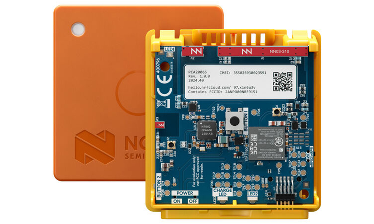
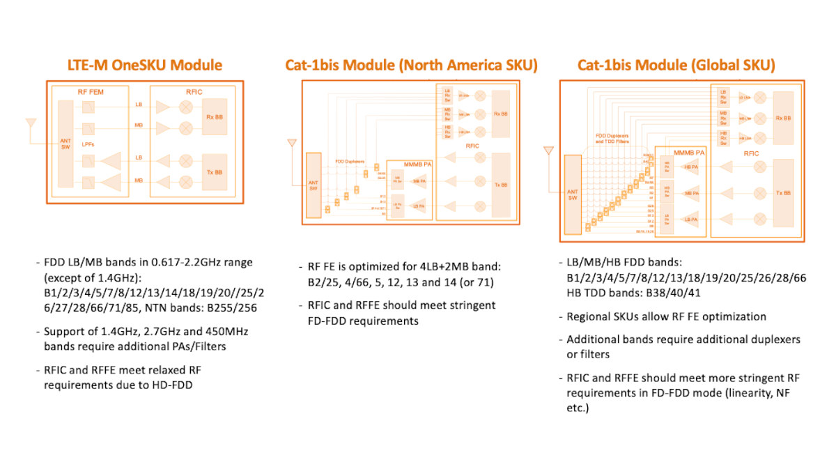
Nordic Semiconductor introduced the Nordic Thingy:91 in mid-2019, a cellular IoT prototyping platform built around the Nordic nRF9160 system-in-package (SiP). It supports LTE-M, NB-IoT, and GPS, and includes features like an Arm Cortex-M33 core, Arm TrustZone security, and flash memory. The platform is ideal for creating IoT Proof-of-Concepts, demos, and prototypes, making it easy to test and deploy IoT applications. The upgraded Nordic Thingy:91 X features the new Nordic nRF9151 SiP, offering support for LTE-M, NB-IoT, GNSS, and DECT NR+ for global connectivity, integrates the nRF5340 SoC for USB and Bluetooth LE, and the nRF7002 IC for Wi-Fi locations. The platform includes sensors for environmental and motion sensing, one expansion connector for Qwiic/STEMMA QT and Grove modules, and antennas for LTE, GNSS, and Wi-Fi. Additionally, the kit also features a Nano/4FF SIM slot, two SIM cards, and a 1,350 mAh Li-Po battery managed by nPM6001 and nPM1300 PMICs, to support field […]
Nordic Thingy:91 X multi-sensor cellular IoT platform combines nRF9151 LTE IoT SiP, nRF5340 BLE SoC, and nRF7002 WiFi 6 IC