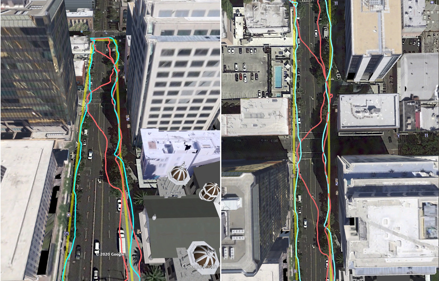
One of the best features of smartphones is GNSS location with standards like GPS that allows you to get directions or share your location with friends or business contacts. It works great in most cases, but getting an accurate location may be challenging in urban areas due to tall buildings that block the signal to the satellites and create reflections.
This can be an issue for ride-sharing apps for example, as the applications may detect the wrong side of the street you are on, either forcing the client to cross the street (when possible) or the driver to take a detour to reach your location. This problem may soon go away in Android phone thanks to 3D mapping aided GPS corrections.
So how does that work exactly? Google explains:
The 3D mapping aided corrections module includes tiles of 3D building models that Google has for more than 3850 cities around the world. Google Play services 3D mapping aided corrections currently supports pedestrian use-cases only. When you use your device’s GPS while walking, Android’s Activity Recognition API will recognize that you are a pedestrian, and if you are in one of the 3850+ cities, tiles with 3D models will be downloaded and cached on the phone for that city.
Inside the module, the 3D mapping aided corrections algorithms solve the chicken-and-egg problem, which is: if the GPS position is not in the right place, then how do you know which buildings are blocking or reflecting the signals? Having solved this problem, 3D mapping aided corrections provide a set of corrected positions to the FLP. A system API then provides this information to the GPS chip to help the chip improve the accuracy of the next GPS fix.
The new feature is part of Android 8 or greater and is known as the 3D mapping aided corrections module found in Google Play services. But there are two versions: version 2 is part of Google’s December Pixel feature drop and works only on Pixel 5 and Pixel 4a (5G). This version reduces wrong-side-of-street occurrences by approximately 75%, while other Android phones have version 1 implemented in the Fused Location Provider API (FLP) and reduces wrong-side-of-street occurrences by approximately 50%. All Android 8+ phones will support the improved Version 2 in early 2021.

Jean-Luc started CNX Software in 2010 as a part-time endeavor, before quitting his job as a software engineering manager, and starting to write daily news, and reviews full time later in 2011.
Support CNX Software! Donate via cryptocurrencies, become a Patron on Patreon, or purchase goods on Amazon or Aliexpress. We also use affiliate links in articles to earn commissions if you make a purchase after clicking on those links.