
We often drive on a bridge fitted with some solar powered equipment, and recently they added a solar powered camera pointing towards the river, so I became curious and decided it would be fun to have a look, and find out what it was all about. There are now 3 solar powered and connected systems.
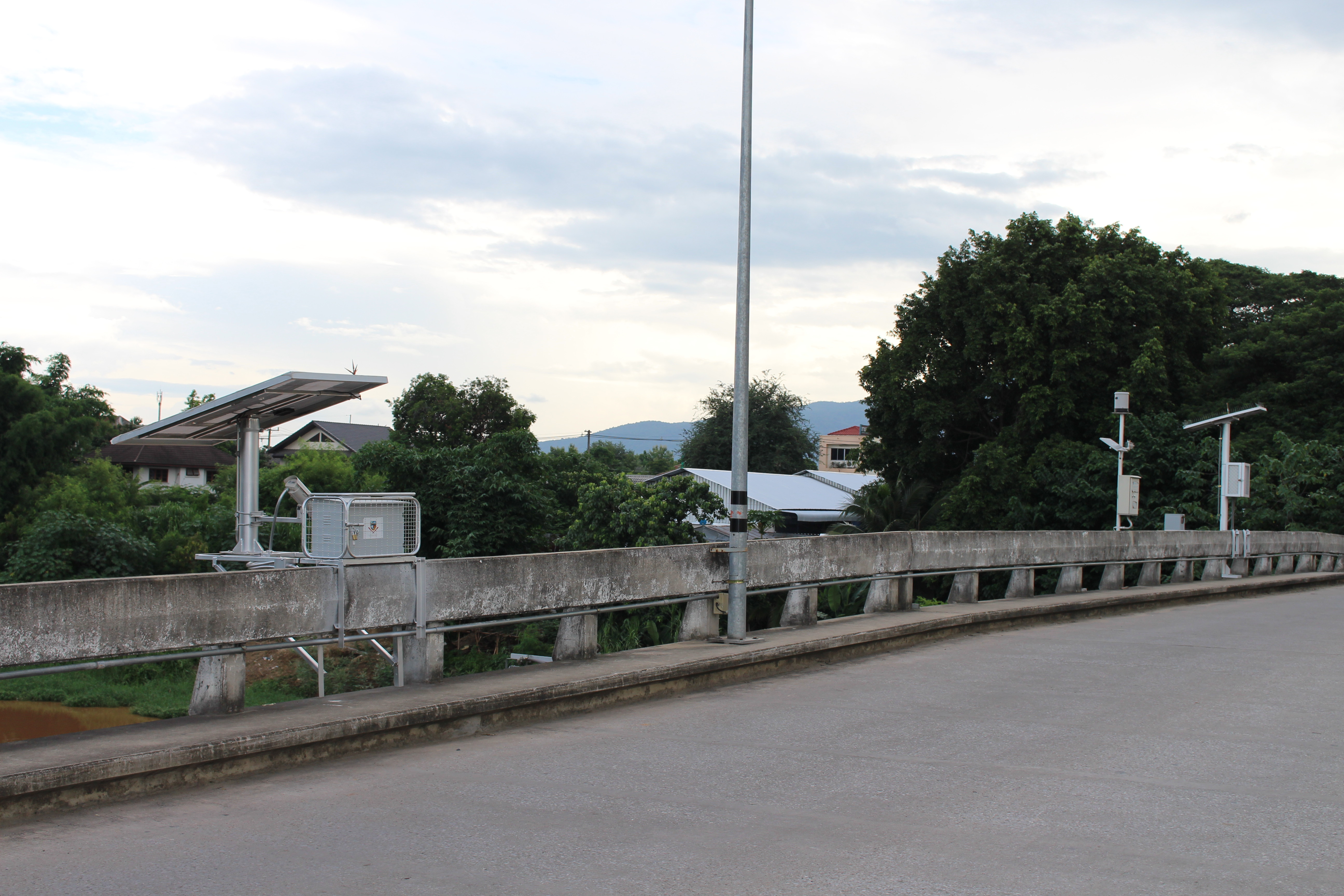
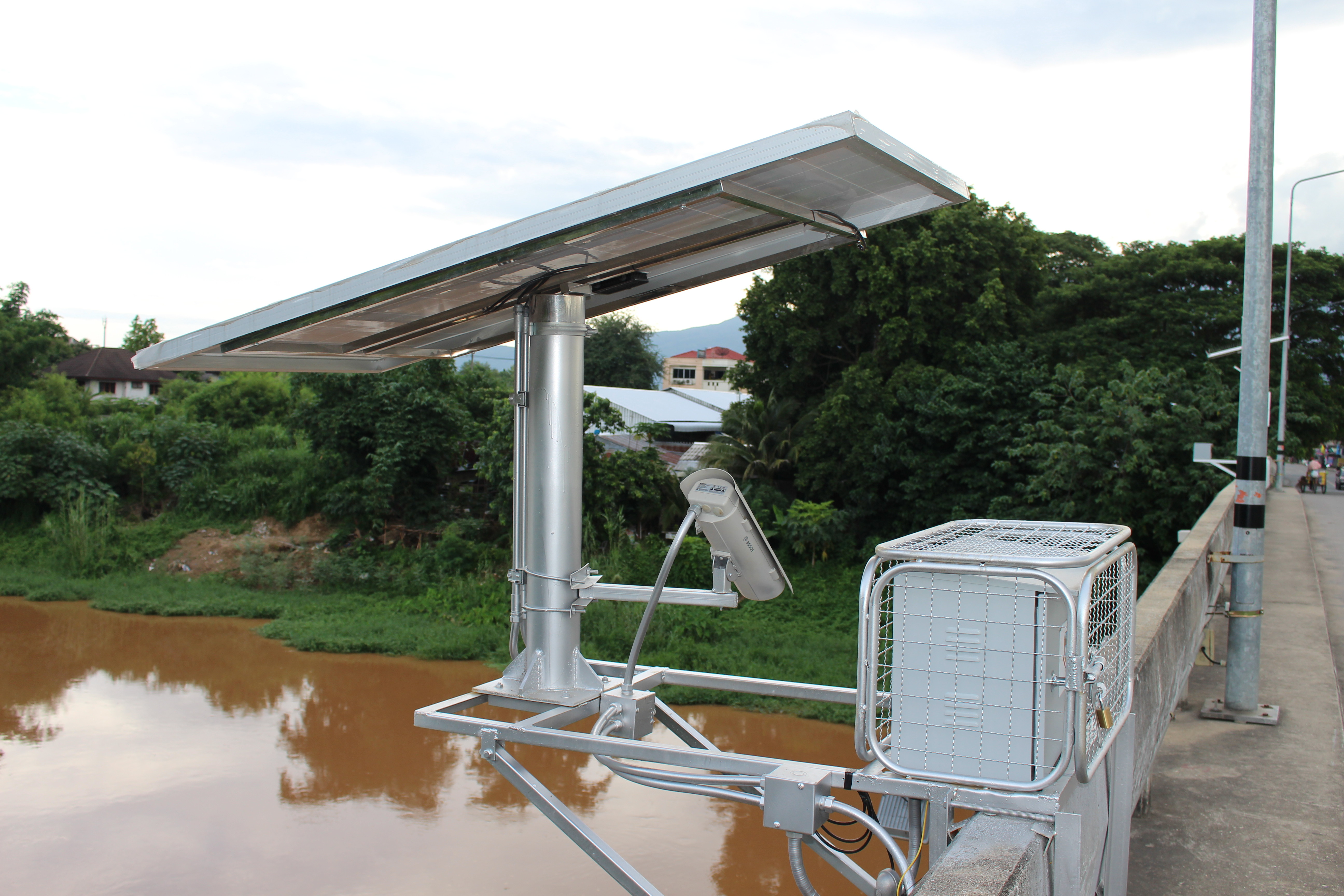
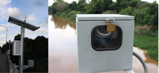
The first system has a larger solar panel connected to a Bosch camera, and a white box…
The sticker on the box gives away the purpose of the system: “National Disaster Warning Center”
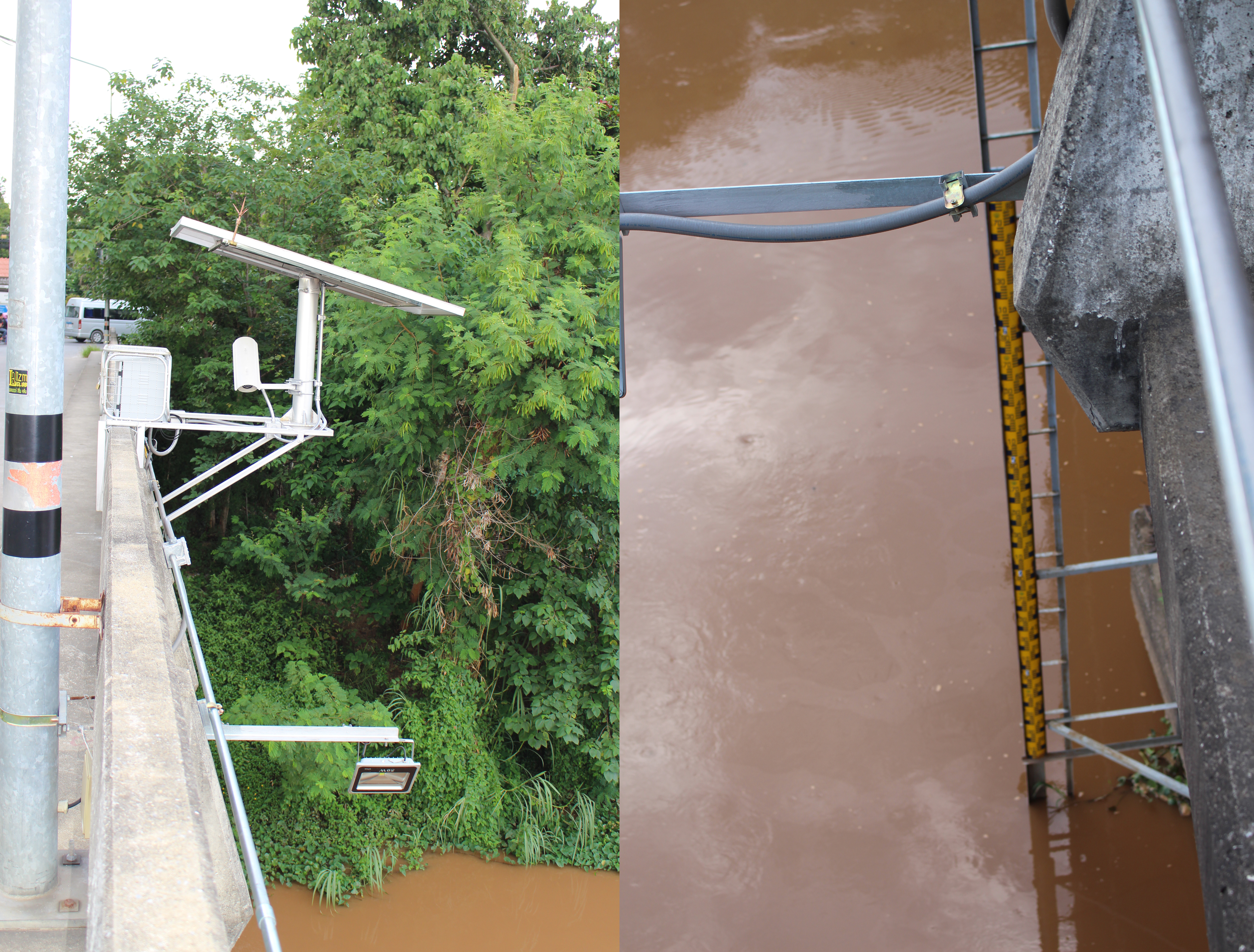
If we look the other side of the system we’ll see an antenna (for 3G/LTE?) as well as a light pointing down to a scale to measure the water level… Probably not the most cost effective way of checking out the level, but it works, and they should have a live feed in case something goes very wrong, and it might be able to measure other characteristics like water velocity.
The system in the middle of the bridge has a different antenna, like a TV antenna, and a cylinder that could be to measure the level of rainfall, and possibly contain temperature and humidity sensors too, as it looks a little similar to another older system.
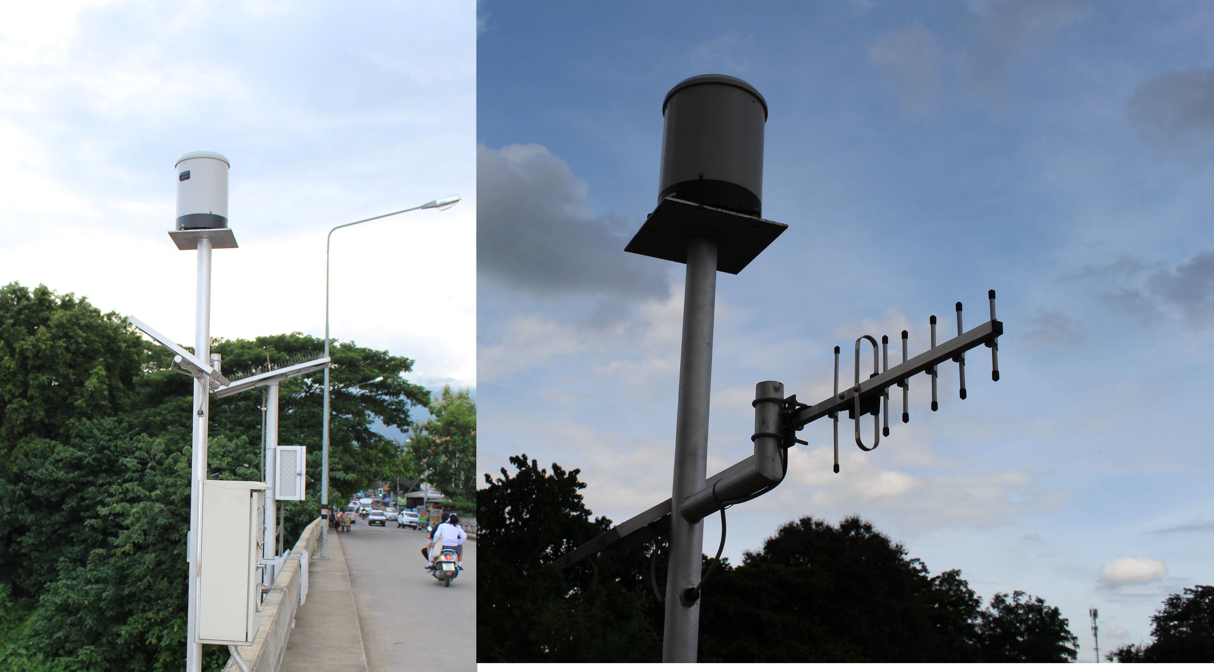
The control box also has a few stickers, explaining the device is used to check water and rain fall level automatically, that such systems are installed in 31 locations and 122 stations, and managed by the “Telemetry station department”. It has apparently been installed or manufactured by a company called Multiproof Co., Ltd specializing in “systems for the Environment instruments and GPS Fleet Management System”.
 I’m less clear about the purpose of the last system with a solar powered meter, and a different type of antenna too. I guess it’s also made to measure rainfall, but I don’t quite understand how that would work.
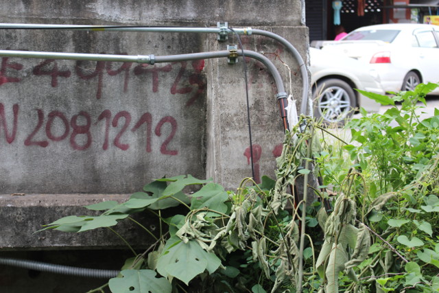
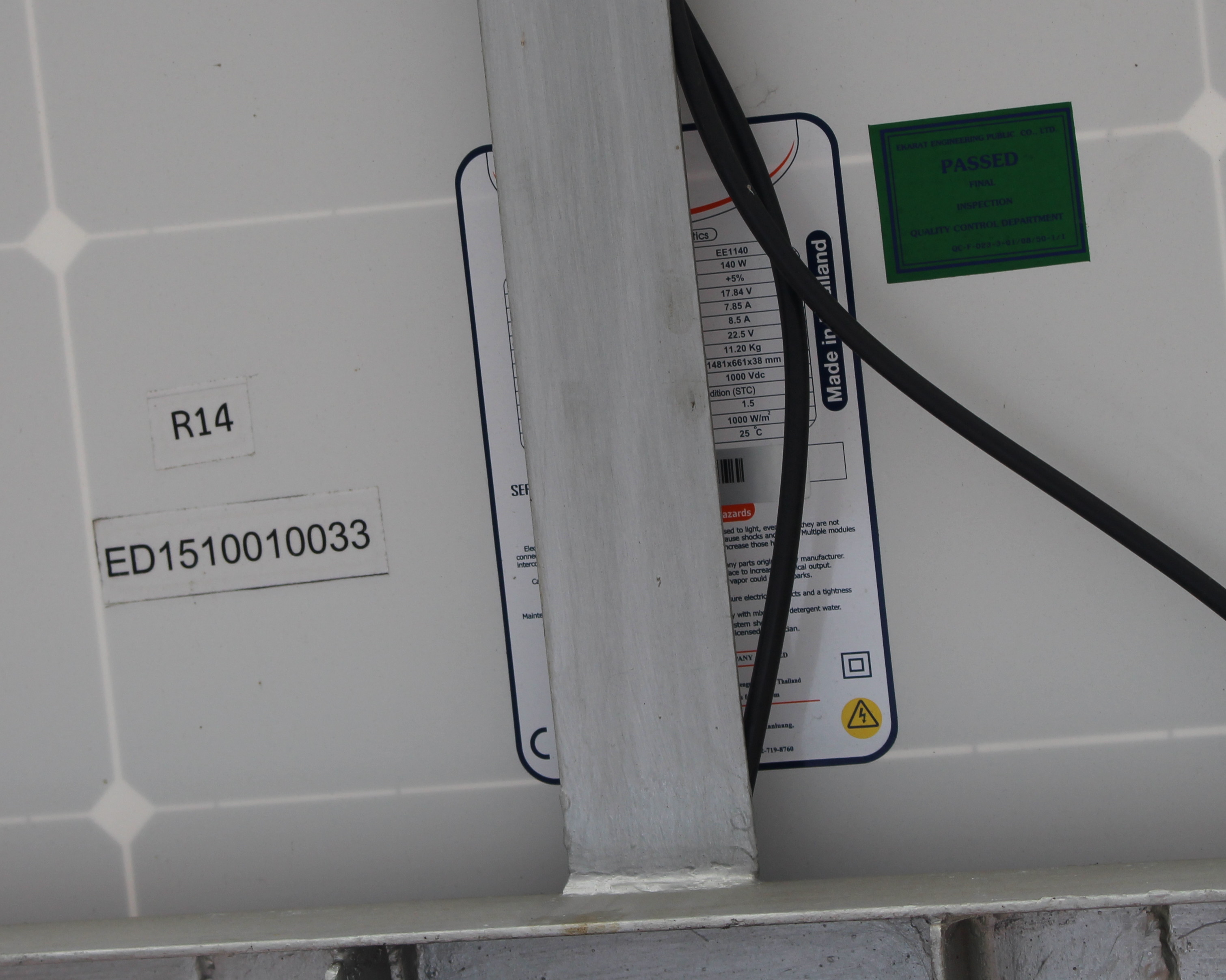 I did check the solar panel details though. That’s a 140W, IP65 panel made by Ekarat Engineering Co. Ltd with an impressive 12 years material and workmanship warranty. All three systems are electrically inter-connected with cables going to the end of the bridge, possibly to some underground battery?
 Since it’s a governmental project, I wondered if data could be available publicly online, but I could not find anything with live or recent data. The project appears to have a started a few years ago, with some more details available on “Mobile Telemeter Development” page.

Jean-Luc started CNX Software in 2010 as a part-time endeavor, before quitting his job as a software engineering manager, and starting to write daily news, and reviews full time later in 2011.
Support CNX Software! Donate via cryptocurrencies, become a Patron on Patreon, or purchase goods on Amazon or Aliexpress


Normally, the right way for checking out the level and to measure other characteristics like water velocity is radar echo.
@Jibril
I can see the company that made the installation also sells this kind of equipment, so maybe it’s there on the bridge too…
Now you anderstand the need of arm low power system, a must have to drop size of solar panel, lipo and cost.
cpu 5w + camera 3W + ADSL 4W wellcome in the hell!
Lora mcu with radar or ultrasonic 🙂
I would guess it could be this project: http://122.154.29.26/NDWC/CCTV/CCTVMap?modify=010101070000
You can check to see if the bridge you are mentioning is on the map – you can chose the station list instead of MAP to see if you cant find the bridge in your “Saphan” in your Ampur or Tambon
@Allan
Good find! The bridge featured in the article is not shown on the map, nor the station list though.