
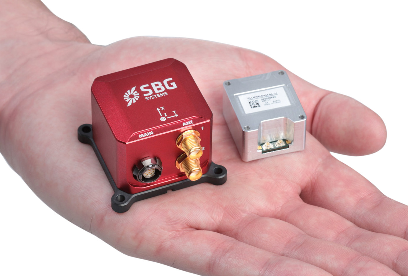
SBG Systems Ellipse-D is an industrial-grade inertial navigation system (INS) equipped with a 9-axis IMU sensor, a dual-antenna RTK GNSS module with one-centimeter accuracy, and a 64-bit microprocessor for processing the data.
The inertial navigation system also includes a temperature sensor and a pressure sensor, supports odometer input, and is available in either Box or OEM versions.
SBG Systems Ellipse-D inertial navigation sensor specifications:
- SoC – Unknown 64-bit microprocessor for data processing
- GNSS – Dual antenna GNSS with support for GPS, GLONASS, GALILEO, BEIDOU; Supported features: SBAS, RTK, RAW
- Sensors – 3-axis gyroscope, 3-axis accelerometer, 3-axis magnetometer, temperature sensors, pressure sensor
- Host Interface
- RS-232, RS-422, USB up to 921,600 bps
- CAN 2.0A/B up to 1 Mbit/s
- Protocols – Binary eCom, NMEA, ASCII, TSS
- Input Voltage – 5 – 36 V
- Power Consumption – < 1,000 mW
- Dimensions & Weight
- Box: 46 x 45 x 32 mm | 65 grams
- OEM: 29.5 x 25.5 x 16 mm | 17 grams
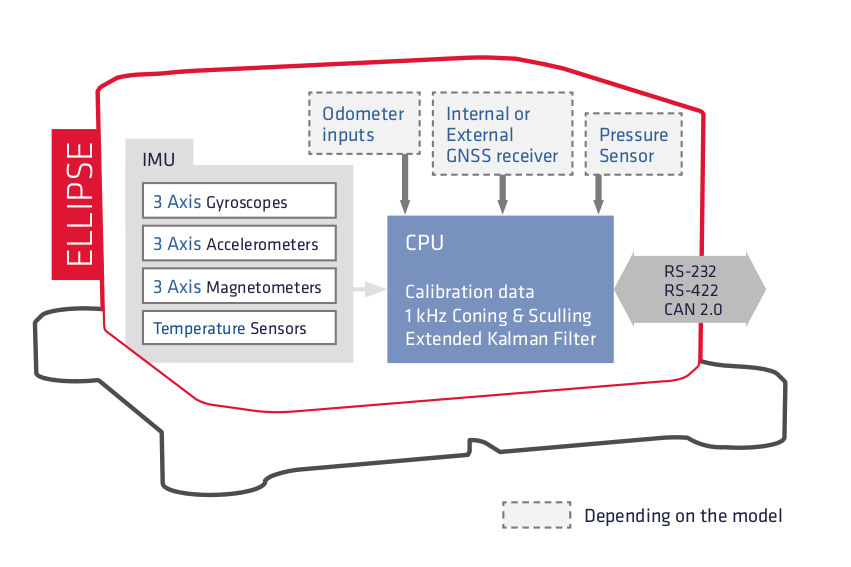 The device outputs plenty of variables after processing sensor data including Euler angles, quaternion, velocity, position, heave, calibrated sensor data, delta angles & velocity, barometric data, status, GPS data, UTC time, GNSS raw data (Post-processing), and more.
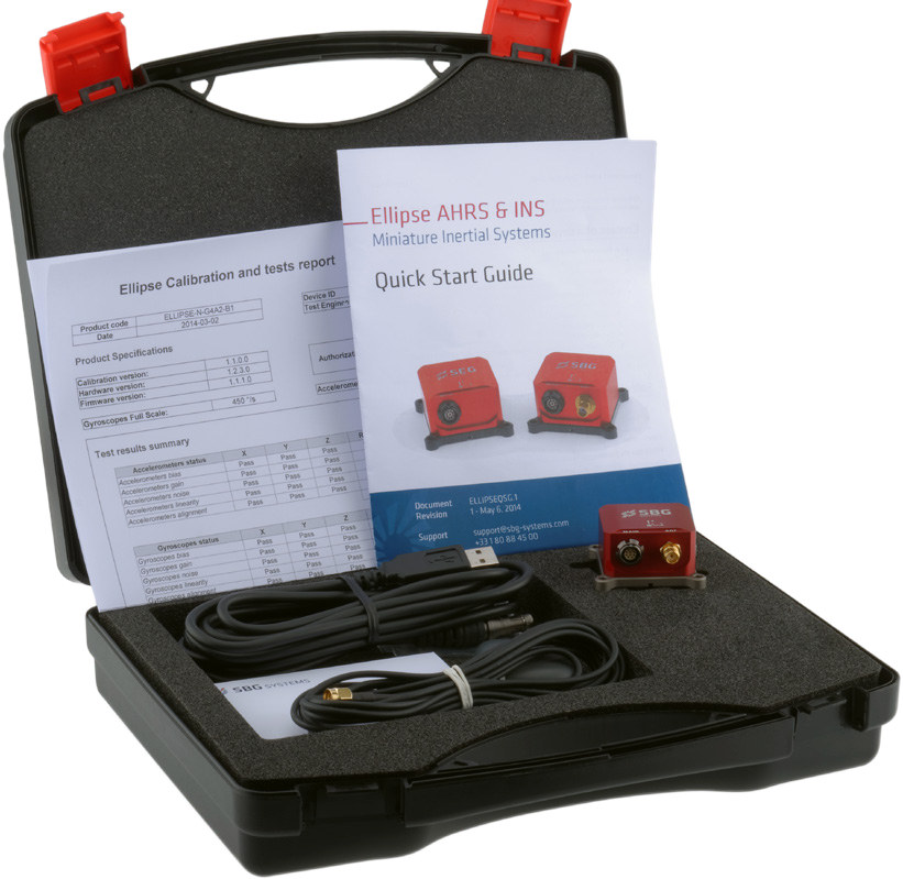
An Ellipse AHRS & INS development kit is available with the company’s earlier Ellipse-A inertial system with a motion sensor only, and the Ellipse-C model very similar to the Ellipse-D system covered here, but featuring a simple GNSS antenna.
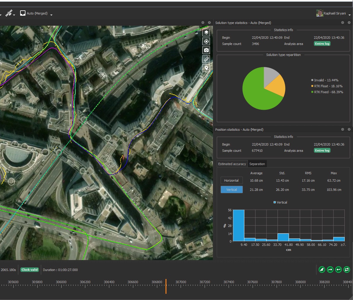
Ellipse INS can also optionally be connected to a PC using Qinertia program which offers the following
- Detailed analysis after the mission
- Replay the sensor data with different configuration
- Refine the mechanical installation (GNSS lever arm) to the centimeter level for improved real-time behavior
- Reach ultimate sensors performance using Forward/Backward/Merge processing
SBG Systems Ellipse-D inertial navigation system can be used for all sorts of vehicular applications including motion & heave monitoring, data georeferencing, gimbaled cameras (e.g. fitted to a helicopter), autonomous UAV/USV navigation, orientation pointing & stabilization, and more.
More details can be found on SBG Systems Ellipse-series product page.

Jean-Luc started CNX Software in 2010 as a part-time endeavor, before quitting his job as a software engineering manager, and starting to write daily news, and reviews full time later in 2011.
Support CNX Software! Donate via cryptocurrencies, become a Patron on Patreon, or purchase goods on Amazon or Aliexpress. We also use affiliate links in articles to earn commissions if you make a purchase after clicking on those links.


Is this subject to any export limitations? Buying an ADIRU for a civilian A/C was always quite fun
No export restrictions. “Ellipse sensors are not restricted to export and ITAR free”
At least something 😉
That export control thingie of pretty much standard things I never got.
You can’t control maths and physics in the long run.
Any hints on price?
I’m not sure about the exact price, but it should be at least several hundred dollars just based on the price of RTK GNSS modules (e.g. $99 for Skytraq PX1122R).
I’d like to see prices. This just screams “likely totally overpriced” on all ends.
I mean, dual-band GNSS receivers usable for centimeter-precision RTK (e.g. the ublox F9P or the Skytraq PX1122R) are already overpriced in general probably due to lack of competition so far in this segment. But this one looks on all ends (housing, case, presentation, site, no openly listed prices etc) like it will probably even be way more expensive…
…for little added value (not that the added stuff like the INS / IMU wouldn’t be nice to have, but you can get those for very cheap so they don’t justify the added price).
It’s really frustrating that dual-band GNSS modules (F9P and Skytraq) are still so expensive. I’m seriously hoping for more competition to enter the field to bring the prices down to an acceptable level.
Beyond the raw material cost, what makes those IMUs expensive is the factory alignment and calibration of the different sensor coordinate systems and the creation of the various correction matrices so you can have properly referenced output. You usuall have to do this static, dynamic and over vibration/temperature ranges which usually takes hours per sensor assembly. This usually pushes the prices of those IMUs into the several 100 to 1000s dollar range.